Maps and Directions
Learning Objectives
- I can explain what a map is and how it is different from a picture.
- I can identify the four main directions — North, South, East, and West.
- I can describe what a compass is and how it works.
- I can read common map symbols and understand what they mean.
- I can use a simple map to find places and give directions.
- I can locate India on a world map and identify its neighbours.
What is a Map?
Have you ever tried to explain to a friend how to reach your house? It's much easier to draw a picture showing the roads and landmarks, isn't it?
A map is a drawing of a place as seen from above. It shows roads, buildings, rivers, mountains, and other important things on a flat piece of paper.
Maps help us find places, plan journeys, and understand the world around us!
| Feature | Picture | Map |
|---|---|---|
| View | Shows things from the front or side | Shows things from above (bird's eye view) |
| Size | Can be any size | Drawn to scale (smaller than real size) |
| Symbols | Shows actual look of things | Uses symbols to represent things |
| Directions | No fixed directions | Always shows North at the top |
| Use | To show how something looks | To find places and give directions |
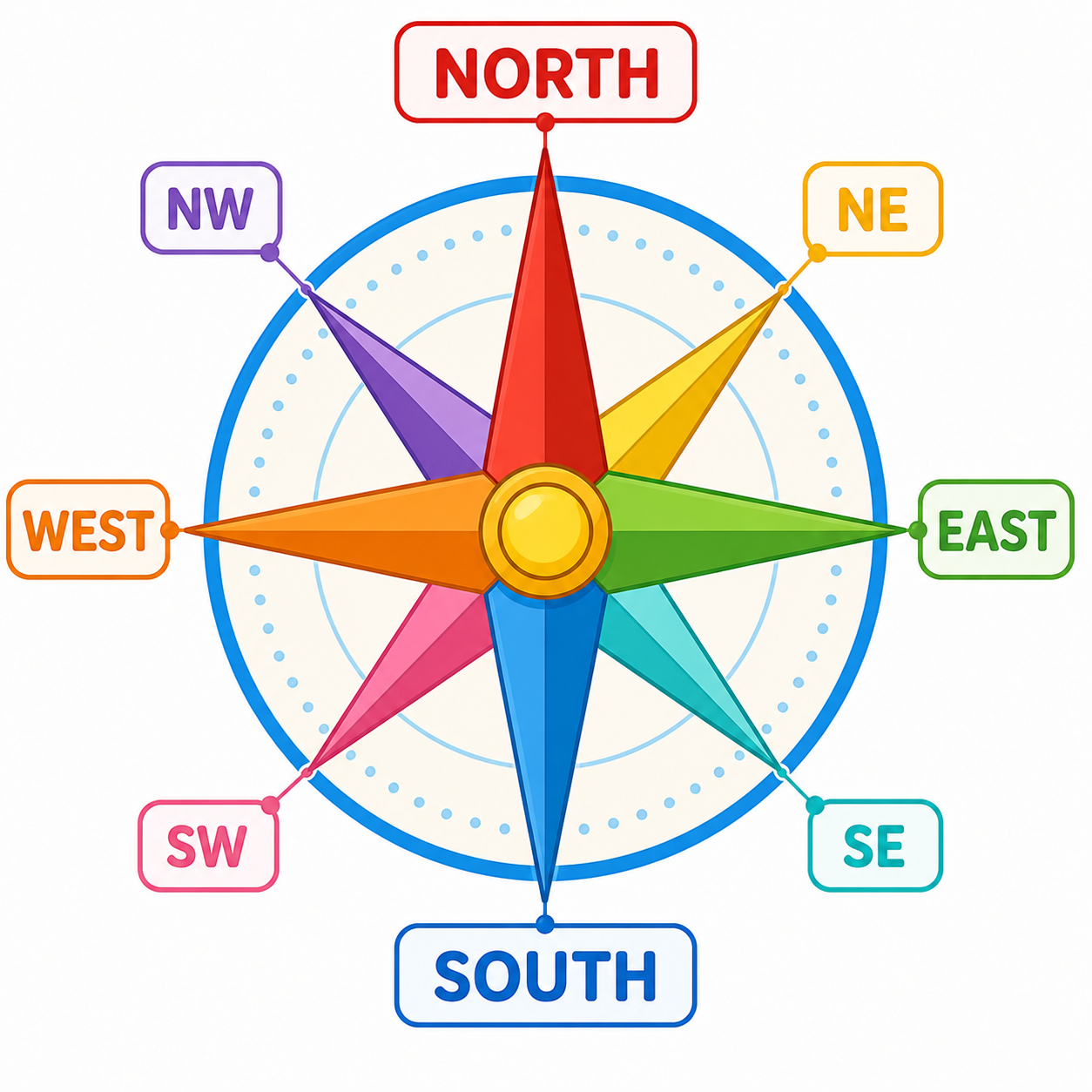
The Four Main Directions
There are four main directions (also called cardinal directions):
| Direction | Short Form | How to Remember |
|---|---|---|
| North (उत्तर) | N | The sun is never in the North |
| South (दक्षिण) | S | Opposite of North |
| East (पूर्व) | E | The sun rises in the East |
| West (पश्चिम) | W | The sun sets in the West |
Stand outside in the morning. Stretch your arms out wide.
- Face the rising sun → you are facing East
- Your back is towards the West
- Your left hand points to the North
- Your right hand points to the South
There are also four intermediate directions (in-between directions):
| Direction | Between |
|---|---|
| North-East (NE) | Between North and East |
| North-West (NW) | Between North and West |
| South-East (SE) | Between South and East |
| South-West (SW) | Between South and West |
The Compass
A compass is a small instrument that always points to the North. It helps us find directions even when we cannot see the sun.
| Part | What It Does |
|---|---|
| Magnetic needle | A thin needle that always points North-South |
| Dial (face) | Shows all directions — N, S, E, W and in-between |
| Glass cover | Protects the needle |
- The Earth acts like a giant magnet.
- The compass needle is also a magnet.
- The needle always points towards the Earth's North Pole.
- Once you know North, you can find all other directions!
Map Symbols
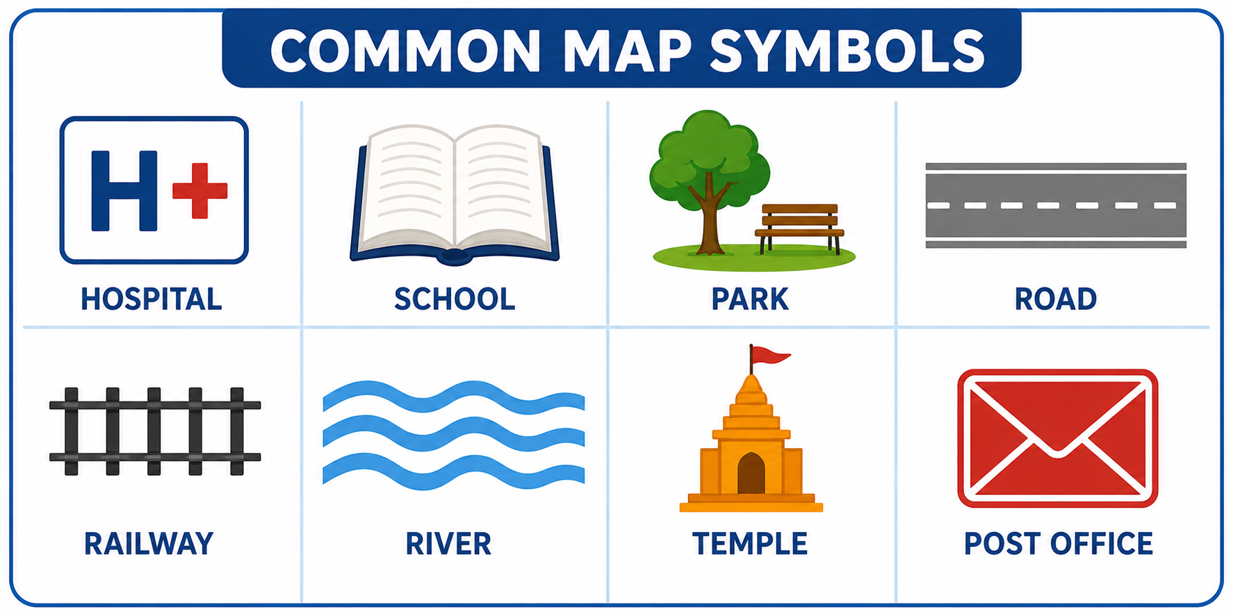
Maps use symbols — small pictures or shapes — to show different things. This makes maps easy to read without writing too many words.
| Symbol | What It Means |
|---|---|
| Blue lines | Rivers and streams |
| Blue patches | Lakes, ponds, seas |
| Green colour | Forests and parks |
| Brown colour | Mountains and hills |
| Yellow/White | Deserts and plains |
| Black lines | Roads and railways |
| Red/thick lines | Main roads (highways) |
| Small squares | Buildings |
| ✈ (plane symbol) | Airport |
| + (plus sign) | Hospital |
| 🏫 (flag on building) | School |
| ✉ (envelope) | Post office |
| ⛪ / 🕌 / 🛕 | Places of worship |
| 🚂 (train) | Railway station |
Every map has a small box called a legend or key that explains what each symbol means.
Reading a Map
To read a map correctly, follow these steps:
- Step 1: Find the title — it tells you what the map shows.
- Step 2: Look at the legend/key — it explains the symbols.
- Step 3: Find North — usually shown by an arrow or "N" at the top.
- Step 4: Find your starting point on the map.
- Step 5: Use directions (N, S, E, W) to describe how to get from one place to another.
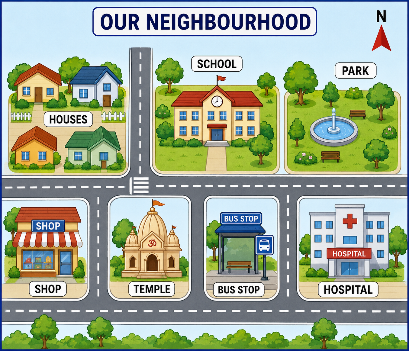
Look at a school map. The library is to the East of the classroom. The playground is to the South. The principal's office is to the North.
To go from the classroom to the library, you walk towards the East (right side of the map).
Style: Flat colourful map, child-friendly, white background
Size: 600×600px
India on the Map
India is a large country in South Asia. On a world map, India looks like an inverted triangle pointing towards the Indian Ocean.
| Direction | What Is There |
|---|---|
| North | Himalaya mountains, China, Nepal, Bhutan |
| South | Indian Ocean, Sri Lanka |
| East | Bay of Bengal, Bangladesh, Myanmar |
| West | Arabian Sea, Pakistan |
- Capital: New Delhi (in the North)
- Largest state: Rajasthan (in the West)
- Longest river: Ganga (flows West to East)
- Highest mountain: Kangchenjunga (in the North-East)
- India has 28 states and 8 Union Territories.
- Neighbours: Pakistan, China, Nepal, Bhutan, Bangladesh, Myanmar, Sri Lanka
Style: Clean flat map, child-friendly colours, white background, labels in English
Size: 600×700px
Key Words
| Word | Meaning |
|---|---|
| Map | A drawing of a place as seen from above, on a flat surface |
| Direction | The way you need to go to reach a place (N, S, E, W) |
| Compass | An instrument with a magnetic needle that always points North |
| Symbol | A small picture or shape on a map that represents something |
| Legend / Key | A box on a map that explains what each symbol means |
| Cardinal directions | The four main directions — North, South, East, West |
| Scale | Shows how much smaller the map is compared to the real place |
| Bird's eye view | Looking at something from directly above |
- A map is a drawing of a place as seen from above (bird's eye view).
- The four main directions are North, South, East, and West.
- The sun rises in the East and sets in the West.
- A compass has a magnetic needle that always points North.
- Maps use symbols — blue for water, green for forests, brown for mountains.
- Every map has a legend (key) that explains the symbols.
- On a map, North is always at the top.
- India is in South Asia, surrounded by the Himalayas (North) and oceans (South, East, West).
Finished learning? Now test what you know!